Home of the Sequim Bay Paddle Guide
Sequim Bay Paddle Guide
Sequim Bay is located on Washington State’s Olympic Peninsula near the town of Sequim (pronounced ‘Skwim’). The bay is one of the most scenic locations in the Pacific Northwest with abundant wildlife and wonderfully rich human history on every shore. Travis Spit protects the bay from the wind waves and swells that occur in the Strait of Juan de Fuca making Sequim Bay a great place to start if you are a first time stand up paddleboarder or kayaker while also providing complex currents for more advanced paddlers and endless scenic opportunities for paddlers of all skill levels. Please use this guide to make your next paddle trip as safe, fun and educational as possible.
DIMENSIONS AND DEPTH
THE STATS
- The bay is about 4 miles long from Travis Spit to the southern end and between 3/4 mile to 2 miles wide depending on how you measure it.
- A paddle trip completely around the bay will be about 10-12 miles depending on the line you take and the tide height.
- The deepest spot in the bay is approximately 126 ft., just east of John Wayne Marina.
- Water temperatures in the Strait of Juan de Fuca range from 44 to 57 degrees Fahrenheit.
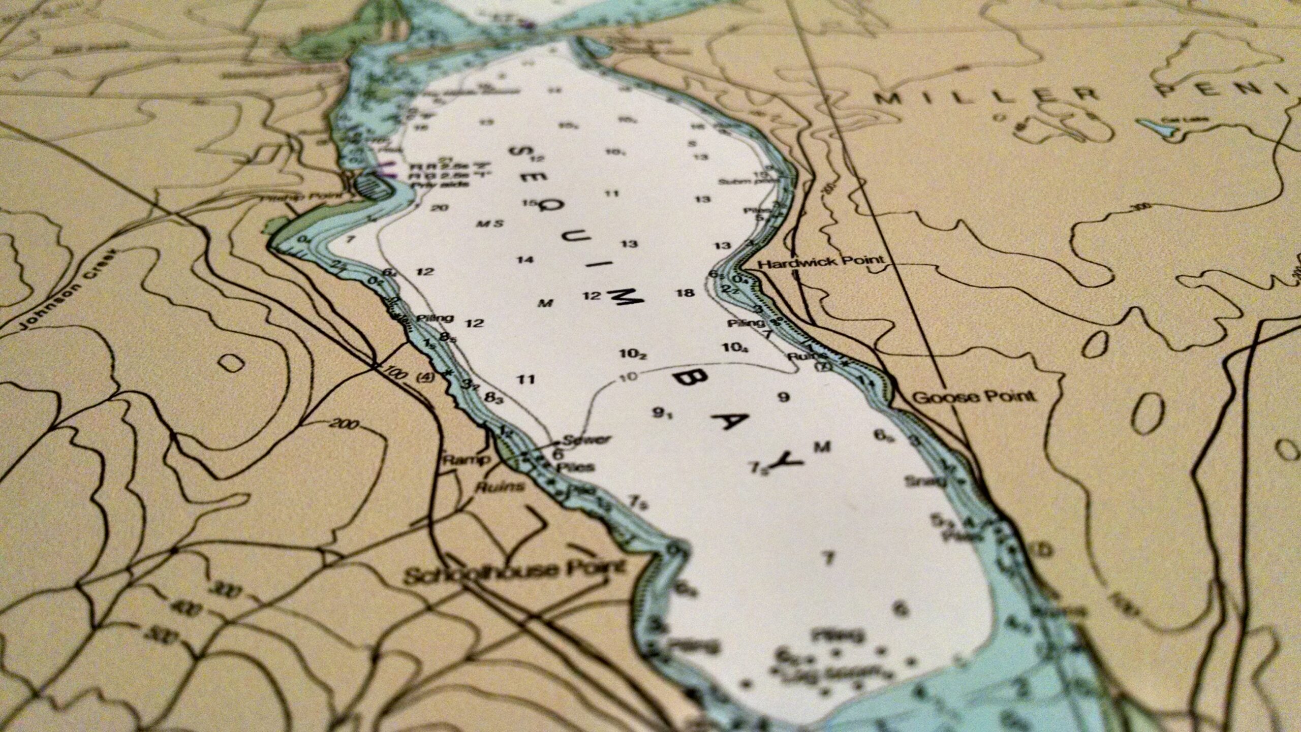
See NOAA’s ENC website (formerly nautical charts) for water depths around the bay. All the depth measurements are in fathoms so multiply by 6 to convert to feet.
WHERE TO LAUNCH
JOHN WAYNE MARINA AND PARK
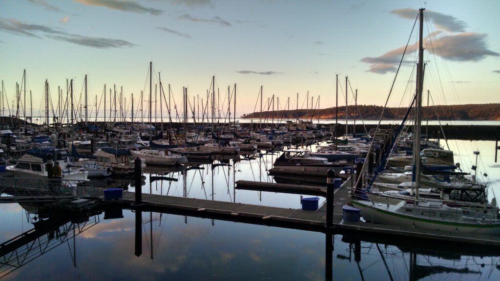
You can launch at the launch ramp inside John Wayne Marina for a fee or you can launch from the adjacent park for free. At the park you must walk down a moderately steep ramp to get to the water and there will be some rocks to navigate. It’s quite shallow and at low tide you will have a long walk to the water. But it is a perfect spot for beginners because it is well protected from wind, current and boat traffic. Good water shoes or at least flip-flops are highly recommended because the beach and launch area has a number of barnacle covered rocks and the area is littered with broken shellfish shells. There is plenty of parking and bathrooms available. We recommend parking your car or RV for the weekend and camping at John Wayne’s Waterfront Resort and dinner at Dockside Grill which are both a short walk away. Port of Port Angeles website
SEQUIM BAY STATE PARK
The dock fee only applies to watercraft needing to use the boat ramp to launch so SUPs and kayakers can park and launch for free. You do need a Discover Pass to park your car which can be bought on-site. The park is right on the Discovery Trail and offers camping and bathroom facilities. The launch area and seawall was completely rebuilt in 2019.
PORT WILLIAMS
One mile to the north, outside of the bay is Port Williams. Marlyn Nelson County Park at Port Williams provides bathrooms, benches and a boat ramp. You can paddle south through the entrance of the bay, past Washington Harbor and inside to enjoy the rest of the bay but watch the tides carefully because the current can be very strong (see Tides and Currents). You can also enjoy exploring the north side of Travis Spit with spectacular views of Protection Island and Mount Baker. See below for more history of Port Williams.
Clallam County’s Port Williams webpage
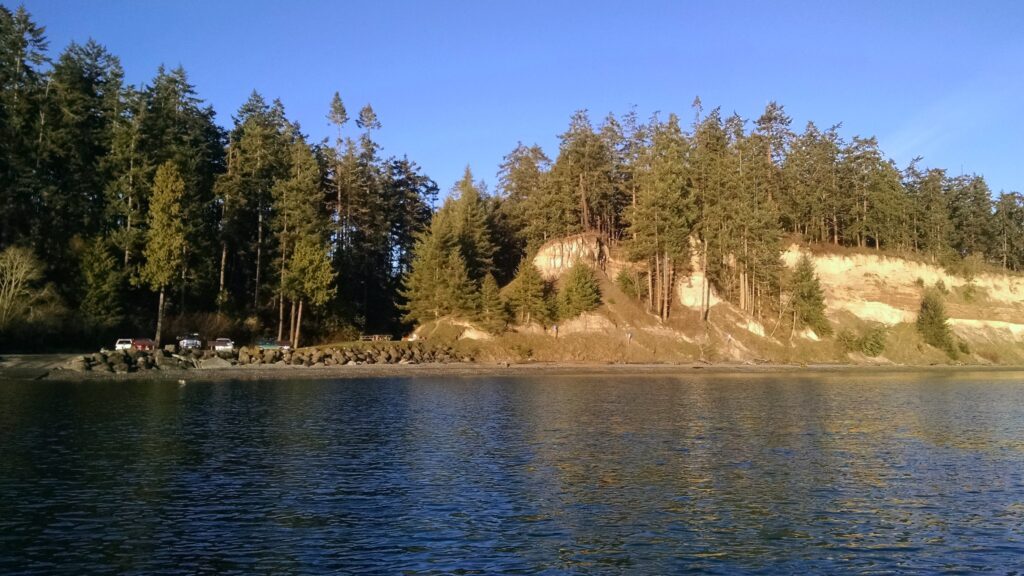
NOTE:
Travis Spit is owned by Battelle and private land owners. No trespassing signs are posted the entire length of the spit. The rest of the bay’s shoreline is also owned by private land owners so landing locations are very limited. Also, keep in mind that many tidelands and shorelines are still used for commercial shellfish operations and should not be used as informal bathrooms for paddlers. So plan ahead and if you need to tinkle, Sequim Bay State Park and John Wayne Marina both have well kept facilities available. 🙂
WEATHER / WEB CAMS
OVERVIEW
Due to the Olympic Mountain rainshadow effect, Sequim only sees an average of 16 inches of rain per year (compared to 36 inches in Seattle) and sees a significantly higher number of sunny days than the rest of Western Washington, earning the nickname “Sunny Sequim.” An article in the Seattle Times Magazine, January 22, 1961 said, “…it is the one spot on the Olympic Peninsula where one can stand under a clear sky and watch the rain falling all around a few miles away. Nobody complains about the weather in Sequim; it’s a place where the residents can enjoy Puget Sound living without rain hoods.”
For the most comprehensive explanation of Sequim’s unique weather see olympicrainshadow.com.
FORECASTS
Weather Underground
Windy.com – The best wind prediction around. If you study the maps through the year you’ll start to really understand the wind and weather patterns here.
CURRENT OBSERVATIONS AND WEBCAMS
John Wayne Marina – Current conditions and 3 webcams (scroll down page for webcams).
PNNL Environmental Monitoring – Weather, Currents, Water Quality
Olympicrainshadow.com weather station – Located 4 miles north of the bay.
New Dungeness Lighthouse – Current conditions and 2 webcams (scroll down page for webcams). Located 8 miles north of the bay.
PADDLER’S TIP: Although it is often sunny at Sequim Bay, there is almost always a light wind during summer days and the temperature generally averages a few degrees cooler than Seattle in the summer (70 degree average in July and August.) The wind is generally from the north and is blowing in cooler air off of the strait. If it’s blowing from the south there is probably a storm brewing somewhere nearby. The good news is that the wind is fairly consistent in the summer. It usually starts around 9:30 am and subsides around 7 pm. With glassy water and the unique quality of the light, I think mornings and evenings are without a doubt the best time to paddle on Sequim Bay during the summer. Other seasons can be less predictable and there are so many micro-climates in Western Washington you can’t really predict the weather here with much accuracy. The best thing to do is plan for wind and rain on every trip and keep an eye on a number of different forecasts and web cams before you head out.
Tides, Currents and Boat Traffic
TIDE AND CURRENTS
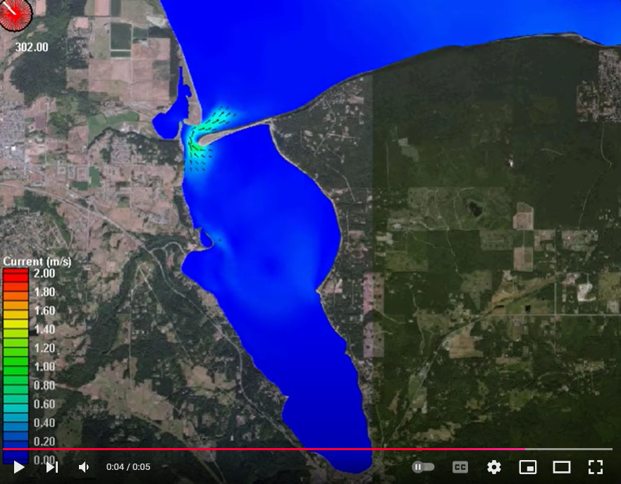
To the untrained eye Sequim Bay resembles a calm lake but anyone who has paddled through the entrance to the bay or in front of the marina while the tide is rising knows the currents are complex and potentially dangerous. Flow in and out of the bay at the entrance (Washington Harbor) can be as much as 3.2 to 3.5 meters per second. The best time to paddle through is at slack tide (as it switches from incoming to outgoing tide or visa versa). Experienced and strong paddlers can use eddys and well-planned routes to get in and out if paddling against a flooding (incoming) or ebbing (outgoing) tide. On an ebb tide, the water can also be rough if there is a north wind as the wind waves and swell from the Strait of Juan de Fuca criss-cross the outgoing current. The south end of the bay is far more tame and you will avoid almost all current if you are south of the State Park.
Pacific Northwest National Laboratory (located at the entrance to the bay) has created a fantastic video that will show you the direction and intensity of the current in the bay over a 24 hour period.
Science is pretty cool.
BOAT TRAFFIC
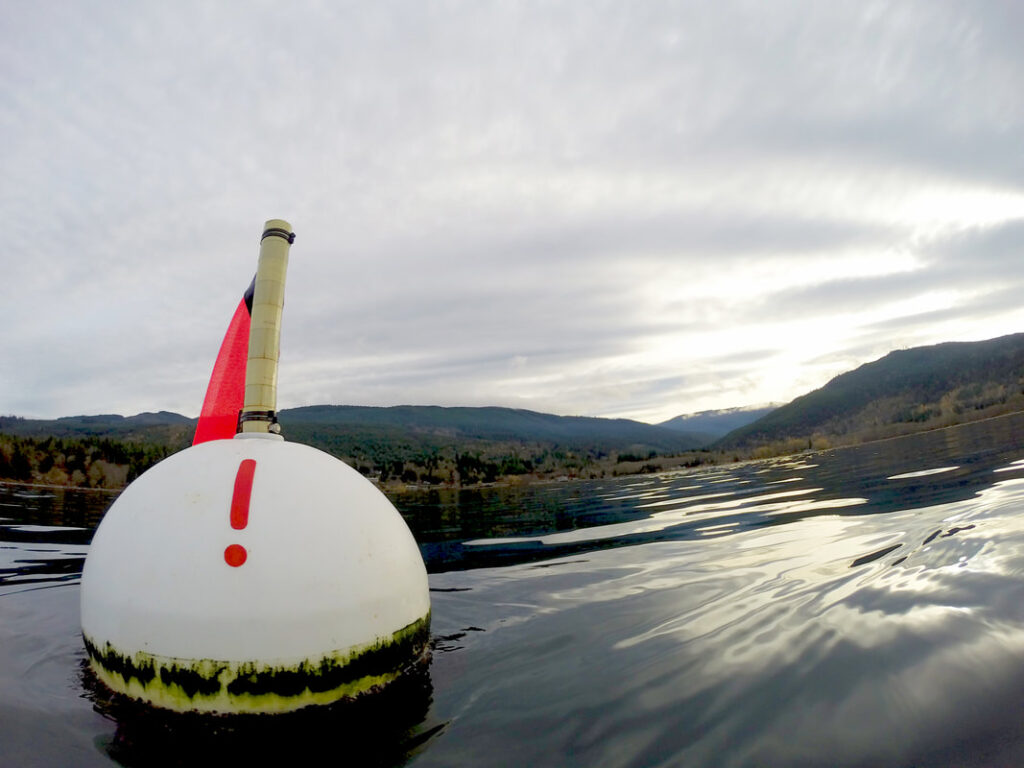
John Wayne Marina is one of the area’s most popular places for boaters and commercial fisherman to launch. Many are headed north, out to the Strait of Juan Fuca and often at a high rate of speed. Travis Spit creates a bit of a blind corner so you may suddenly find a boat bearing down on you as you cross from one side to another. Luckily there are channel markers that create a nice “highway” for them to travel and for paddlers to avoid. To stay out of their way, don’t dilly dally at the entrance to the marina or the entrance to the bay. If on the western side of the “highway,” stay west of the red buoy then stay very close to shore as you approach the PNNL lab site. The other option is to stay east of the channel markers toward the center of the bay.
PADDLER’S TIP:
What do the buoy colors mean for those boaters? The easiest thing to remember is RED, RIGHT, RETURN. If the buoy is RED, it should be on the boat’s RIGHT, if it’s making its RETURN trip back to the marina.
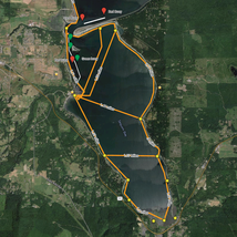
SEQUIM BAY PADDLER’S GUIDE MAP
We’ve created a custom Google map to show you:
* All the points of interest listed below
* Distance measurements between locations
* Locations of buoys and regular boat traffic
Once you’ve opened the map, use the checkboxes on the left to display more or less data.
History and Points of Interest
OVERVIEW
Any discussion of the history of Sequim Bay starts with the S’Klallam people (sometimes spelled Klallam or Clallam). Tribal ancestors have made Sequim Bay and the surrounding area their home for centuries and the current Jamestown S’Klallam Tribal headquarters and administrative buildings are appropriately located at the head of the bay in Blyn.
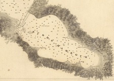
Spanish and English explorers began to arrive and map the area in the early 1790s with Capt. George Vancouver’s expedition being the most notable. But both Vancouver in 1792 and Spanish explorer Manuel Quimper in 1790 failed to spot Sequim Bay behind the long sand spit that separates it from the Strait of Juan de Fuca. Spanish ships commanded by Francisco de Eliza were the first to name the bay “Ensenado de Bertodano” in 1791. In 1841, the United States Exploring Expedition under the command of Lt. Charles Wilkes was the first to map the bay and name the various sandy points located around the harbor. The Wilkes Expedition’s name for the bay was Budd’s Harbour and only Pitship Point and Kiapot Point retain the name given to it by this US expedition.
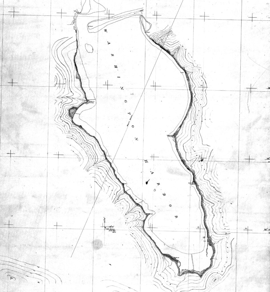
The name “Sequim” originates from the S’Klallam village at the entrance of the bay called Suxtcikwi’in. An early and incorrect translation of the word was “quiet waters” but the correct meaning from the S’Klallam language is “place for going to shoot,” relating to the plentiful hunting opportunities of waterfowl and elk in the area. The area is rich with naming controversies and Sequim Bay is no exception so you will see some older maps calling the entire bay “Washington Harbor” when in fact that is only the name of the area near the entrance to the bay.
With the arrival of the earliest white settlers and continuing on to present day, the bay and surrounding communities have been home to industries such as logging, agriculture, shellfishing and scientific research while providing endless outdoor recreational opportunities for locals and tourists alike.
WANT TO READ MORE?
Fish Tales of Sequim Bay by Harriet Fish (1985)
This pamphlet is a nice little resource for the overall history of the bay.
Available for purchase at the Sequim Museum and Arts Center.
Klallam Folk Tales and Klallam Ethnography by Erna Gunther (1927)
Essential reading for S’Klallam history. Most other history books on the Tribe cite Gunther as a source.
Read now on Google Books
PITSHIP POINT / JOHNSON CREEK / JOHN WAYNE MARINA / JOHN WAYNE’S WATERFRONT RESORT
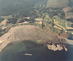
In the late 1800’s, Pitship Point, also known as Cannery Point at that time, saw a trading post, post office, log dump and cannery all come and go, mostly relocated to Blyn by early pioneer Benjamin F. Dean. But artifacts found in the area show that the original residents, the S’Klallams, were making use of Pitship Point for at least 2000 years before any of the early white settlers. Today, Pitship Point and the adjacent Johnson Creek are home to John Wayne Marina and John Wayne’s Waterfront Resort. Actor John Wayne visited the area on his boat the Wild Goose and fell in love with the area. In 1968, he purchased a large tract of land and donated a portion so that a marina could be built. Constructed in 1985, the marina is operated by the Port of Port Angeles and features Dockside Grill restaurant, boat ramps and moorage, a public park as well as bathroom and laundry facilities.
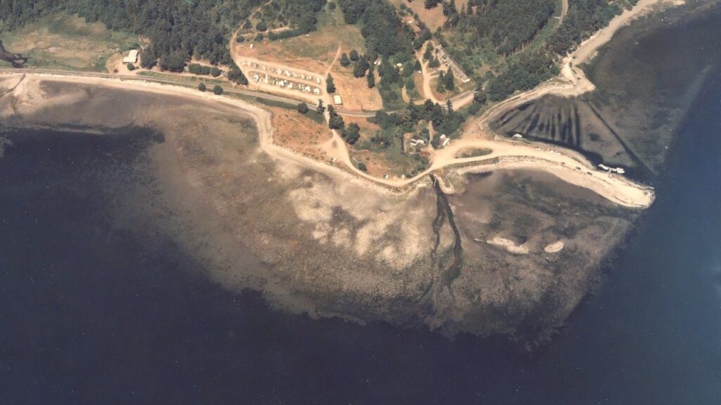
Click the picture above to go to the Department of Ecology Coastal Atlas Shoreline Photo site and see what Pitship Point looked like before John Wayne Marina was built.
John Wayne’s Waterfront Resort is still owned by the Wayne family and provides historic cabins, camping and RV sites with amazing views of Sequim Bay. The site has long been used as a vacation destination, previously as Silver Sands Resort, Hague’s Resort and Trailer Park, and even earlier as Johnson Creek Auto Camp.
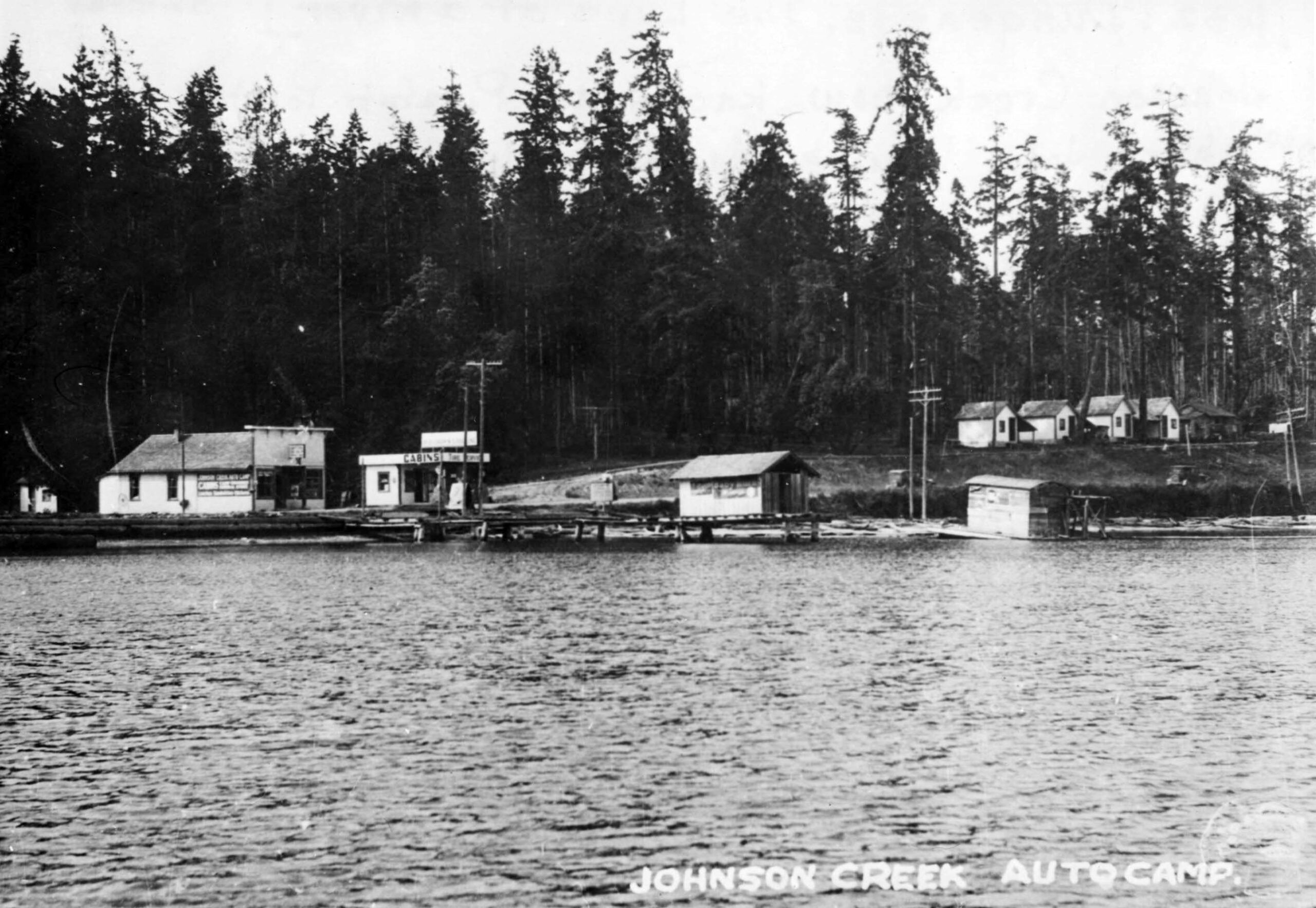
— Image courtesy of the Museum and Arts Center in Sequim-Dungeness.
Unknown date but the cars on the road appear to be from the 1920s.
FUN FACT: John Wayne’s yacht, “Wild Goose” began its life as a mine sweeper during World War II. Wikipedia has more info.
WASHINGTON HARBOR
S’KLALLAM VILLAGE – Located at the entrance to the bay, Washington Harbor has the most documented human history of any site on the bay. Radiocarbon dating shows tribal activity here going back more than 600 years at the S’Klallam village known as Suxtcikwi’in. Maps from 1841 and 1870 show a longhouse in this location and ethnologist Erna Gunther documented a village here from 1875-1880 with 10 lodges and over 40 residents. Gibson Spit, to the Northeast was used as a burial area. It was disrupted by a powerful storm in 1891 in which tidal surges scattered remains and burial items. As white settlers and entrepreneurs moved into the area, the Native America’s were pushed out with some living just across the channel on Travis Spit and working for the cannery that took the place of the village.
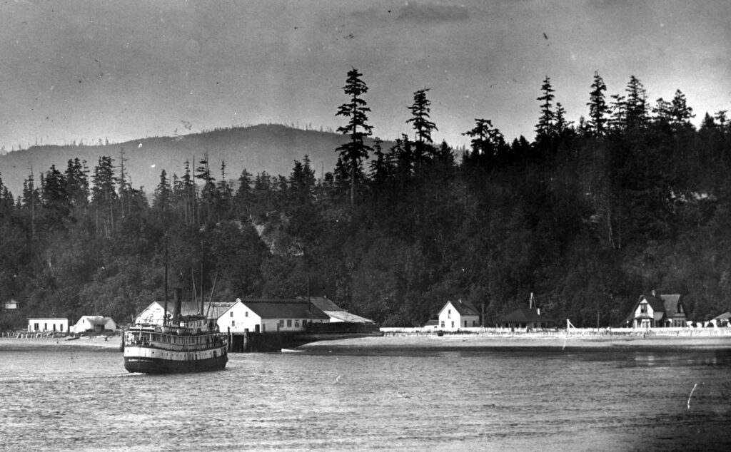
BUGGE FAMILY CANNERY, CREAMERY AND DOCK – A cannery operated at Washington Harbor as early as the 1880s and a large Victorian home was built in 1889. Sequim pioneer Hans J. Bugge is the most notable developer at the site. Hans, and later his son Anphin, operated the cannery here for more than 60 years. The cannery had 30-40 employees and at its peak, shipping 10,000 cases of clams per year under the names Moon Kist and Tureen.
The site also included a creamery and the dock served as the primary port for commercial ships of the Mosquito Fleet until the wharfs at Port Williams and Dungeness were built. Children arrived by boat to a small schoolhouse that also sat on the property until it was moved to a nearby hillside due to winter tidal flooding. In 1910, Hans Bugge replaced the previous home on the site with a 6-bedroom Georgian style home which stood well into the time period of the next owners, Battelle. (The picture to the right shows Washington Harbor before the Bugge home was built.)
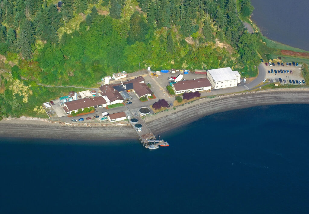
BATTELLE – In 1966, Battelle Northwest purchased the property and developed it into a marine research laboratory. Local aquaculture expert Peter Becker Ph.D., owner of Olympic Aquafarms and former Senior Scientist at Battelle Marine Science Laboratory tells us, “The Pacific Northwest National Laboratory Marine Sciences Laboratory (PNNL-MSL) is a US Department of Energy (DOE) owned facility under the direction of the Pacific Northwest National Laboratory in Richland, WA. It was established as an up wind air monitoring and reference station during the open atmospheric nuclear weapons testing period and an air reference station for the Hanford Nuclear production facility on the Columbia River and other facilities in Idaho. It has been managed since 1966 under a contract to the Battelle Memorial Laboratory in Columbus, OH, which currently manages or co-manages, Hanford, and some 6 other DOE nuclear facilities around the United States.”
During the lab’s construction a number of Native American artifacts were excavated and one human skeleton was found. The Bugge’s Georgian home remained onsite until 1981.
Recent research at the lab has produced a predictive ocean modeling tool for the Salish Sea to study the effects of climate change while also providing insight into future water quality management issues and shoreline restoration planning. Additional projects have focused on creating alternative energy from natural ocean resources and finding ways to mitigate biofouling.
WANT TO READ MORE?
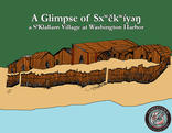
A Glimpse of Sxʷč kʷ i’ŋ a S’Klallam Village at Washington Harbor (2018)
This e-booklet provides the most comprehensive history of the Tribe’s history at Washington Harbor.
Available for download (PDF) from the Tribal Library.
THE MIDDLE GROUND
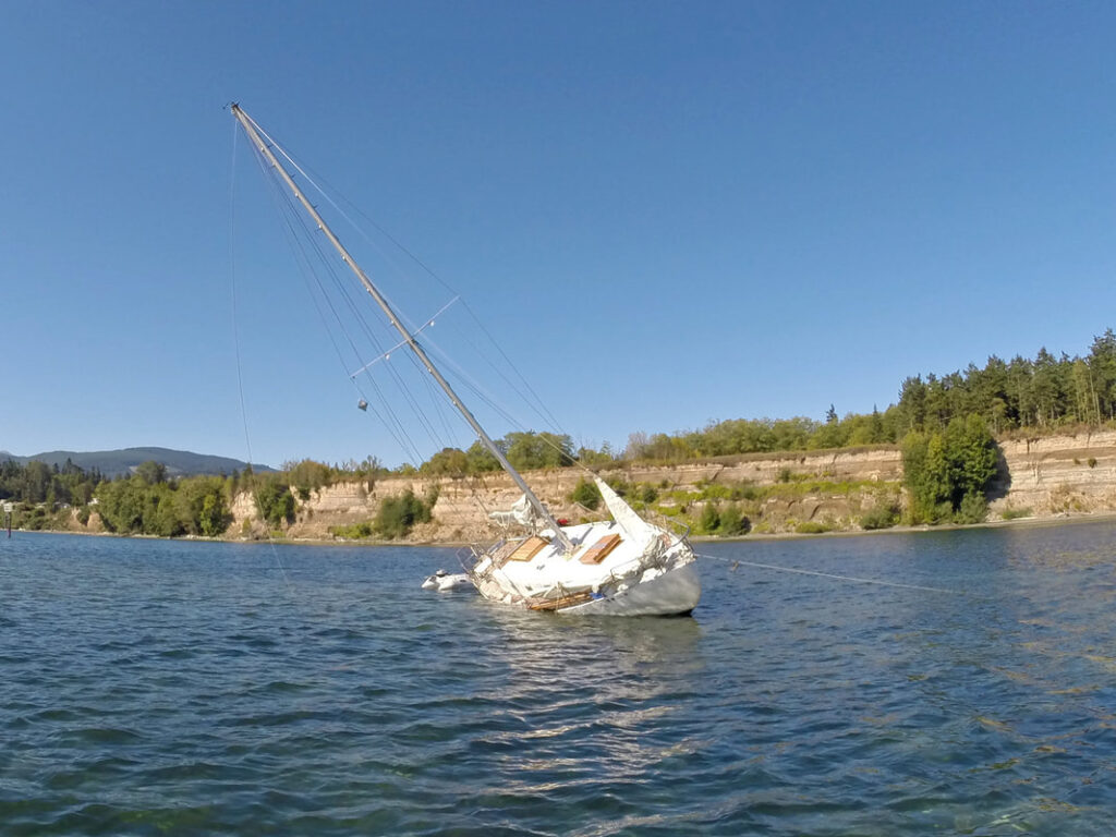
Just inside the entrance to the bay is a sandy shoal known as the Middle Ground. Google maps show it quite clearly but it only reveals itself at lower tides. It has served as a prime spot for clam harvesting going back thousands of years and is currently owned by Battelle. The Middle Ground can be a sneaky enemy of boats that don’t follow the channel markers in and out of the bay. It will hide just below the surface on certain tides and with strong currents entering the bay in that location, boats have been known to run aground there including the famed tall ship Lady Washington on July 24, 2017. It happens to boats of all shapes sizes as you can see in the picture here. The same current and shallow water that grounds boats will push your paddleboard or kayak right into the rocks too if you aren’t careful (I know this from experience unfortunately). Be careful out there!
PARADISE COVE / TRAVIS SPIT
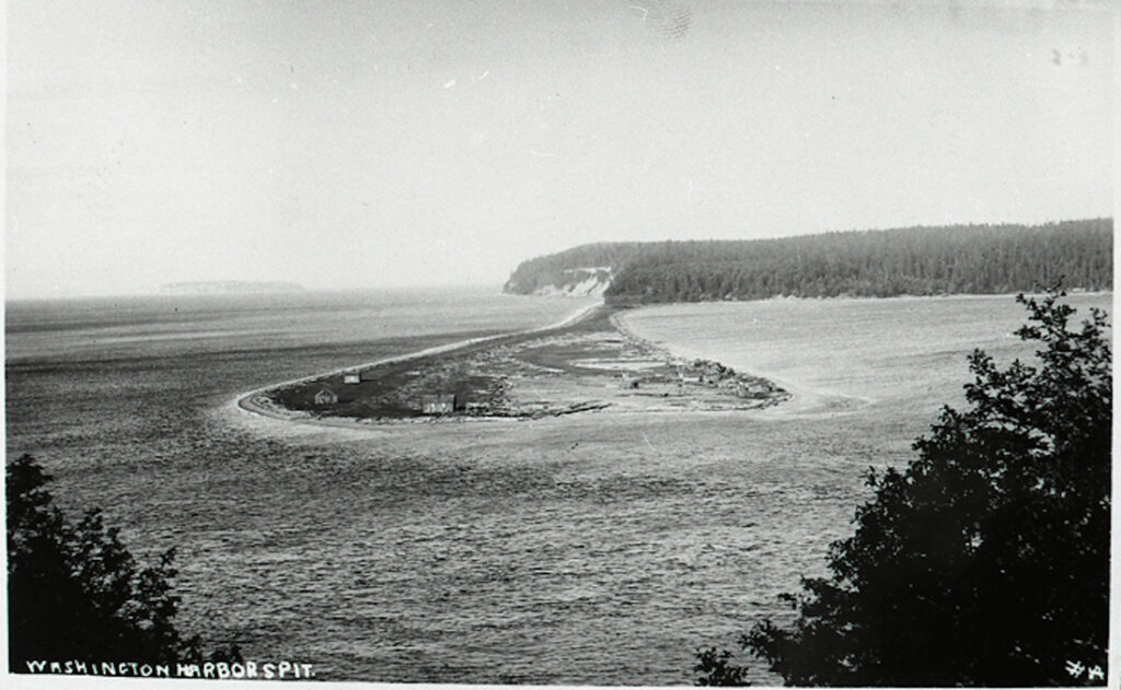
TRAVIS SPIT – Like the many sand spits in this area, Travis Spit was created by the erosion of nearby bluffs whose sediment was transported by wind and current to form a long narrow land mass. Travis Spit protects Sequim Bay from the wind waves and swell produced in the Strait of Juan de Fuca creating a perfect saltwater harbor for boats and recreation while connecting Sequim to the entire Puget Sound. The western end of the spit is known as Kiapot Point.
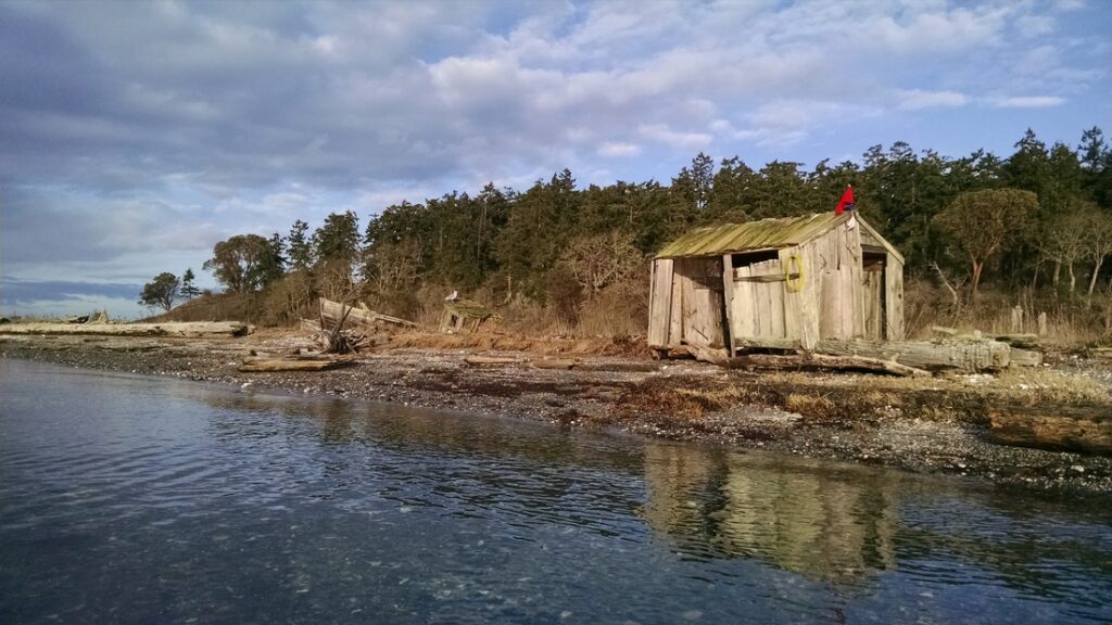
The spit was home to a trading post as early as 1853 and number of S’Klallam lived on the spit after white settlers moved into the Washington Harbor site with many working for the cannery. During the Great Depression, Sequim Bay saw its own version of a Hooverville community spring up when a number of single men built one room shacks here and on the spit outside Paradise Cove. They mostly sustained themselves by eating the abundant clams and other shellfish at the shoreline. There were as many as 25 shacks here at one time and it’s fascinating as you paddle by the few that are still remaining to imagine living in such a meager dwelling.
PARADISE COVE – This might be one of the most beautiful and intriguing spots on the bay. A number of the Depression-era shacks mentioned above still reside on the sand spit that protects this small cove as do two boats from the same time period. One boat belonged to a man known as Capt. Taylor who lived on the boat until it was no longer seaworthy, forcing him to move into one of the shacks on the beach. Taylor was the last of the group of squatters and was still there well into the late 1960s.
Paradise Cove also served as a hideaway for smugglers. During the late 19th century, Chinese laborers, opium and wine were smuggled across the strait from Canada to various locations from Dungeness to Discovery Bay. The prohibition era also saw a rise in smuggling activity and Paradise Cove’s secluded location was easily out of the sight of law enforcement. Little documentation can be found about these activities at what was sometimes called “Pirates Cove,” but stills and liquor caches were often found and many lights and a lot of foot traffic was noted at night.
The land around Paradise Cove is currently owned by the collective group of property owners and therefore all private property. The association shares a pool and tennis courts and employs a caretaker. John Treadwell served as caretaker for more than 30 years and built and resided in the small cabin that sits at the entrance to the cove. He was given the opportunity to name the houses around the property in the 1960’s and decided to let them share the moniker of rivers that flowed from the Olympic mountains such as Duckabush, Soleduck, Dosewallips and Humptulips. Treadwell was so beloved and his work on the property so admired that on his 86th birthday, the small spit in front of the cove was named Treadwell Spit by the residents.
WANT TO READ MORE?
Sequim Bay Point by Patricia L. Lucus (1993)
This self published book focuses on Paradise Cove but provides a comprehensive history of the entire bay.
Available at the Jamestown S’Klallam Tribal Library.
SUNKEN VESSEL
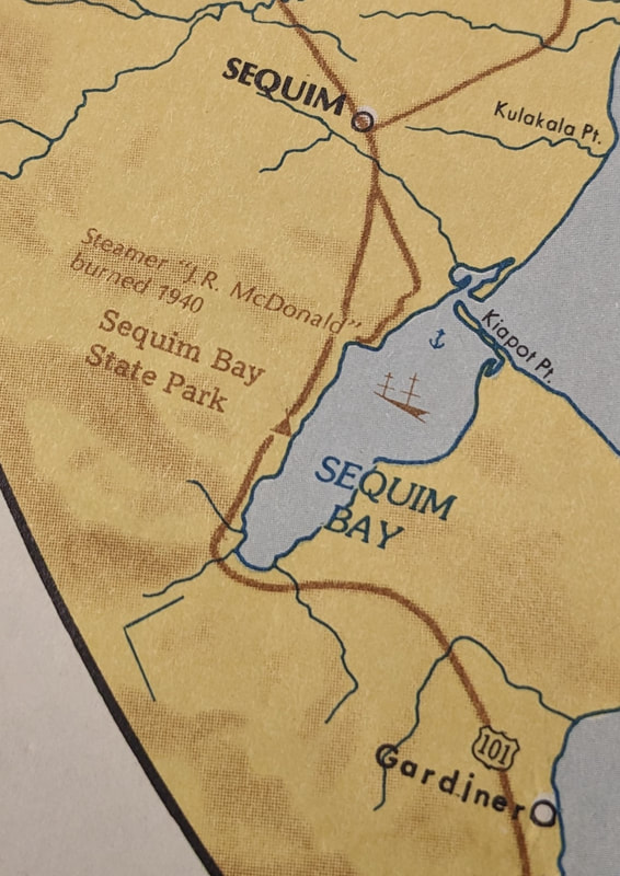
This mystery first revealed itself on the nautical chart for the bay where the symbol for a shipwreck appears near the center of Travis Spit. Further examination on Google Maps and the Department of Ecology’s Shoreline photos clearly show the outline of a moderate sized vessel. After paddling out I discovered it in very shallow water with what looks like a smokestack reaching up toward the surface and a tiny buoy to mark its location. It’s really amazing to see on a sunny, windless day as the eelgrass suddenly ends and you begin to see shapes and angles of the debris below you. The bay for the most part has reclaimed her so you can’t really see the full structure of the boat but you can easily decipher the outline of where it rests including what looks like a large square hatch or basket toward the northern end and the smokestack to the south. The smokestack looks as if it’s barely standing and is in very shallow water so be careful as you paddle near it.
So what is it and why is it there? With the help of the Sequim Museum and Arts Center, we discovered it was a floating clam cannery. The details and accounts of this boat are still a little fuzzy, but we know the boat was one of four boats run by the Bugge cannery. Based on a map of shipwrecks I ran across, I believe it was named the J.R. McDonald and was scuttled in 1940. The Bugge family not only operated their main cannery at Washington Harbor (see above) but they also employed floating canneries that processed clams from Hood Canal and the San Juan Islands to British Columbia and Alaska. In her book Sequim Bay Point, author Patricia L. Lucus mentions, “The portable cannery that had been used in British Columbia and Hood Canal sank in Blyn Harbor. It was towed to the south side of the spit where it was beached and eventually rotted.” The clamming business had waned and the floating cannery was no longer needed. S’Klallam Tribal Elder Marlin Holden remembers the cannery being intentionally sunk, not only because it wasn’t needed but possibly to create an underwater habitat. He watched the sinking and says, “once it started to go, it went under fast.”
We are lucky enough to have a picture of a Bugge floating cannery as it was moored in the San Juan Islands (right). I don’t believe this is the same boat that is currently underwater in the bay because the picture is dated 1947 and “our” boat was supposedly scuttled in 1940, but to my eye it appears to be a similar size and shape. A story told to the Lopez Island Historical Society by Clark Lovejoy describes working on the A.R. McDonald. This sternwheeler had no paddlewheel and a boiler in the bow and would have to be towed by other Bugge boats the Lincoln or the Phoenix which also served as fish tenders.
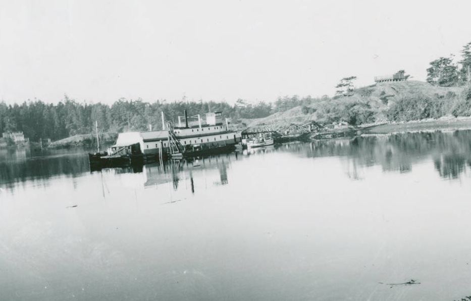
The back of the photo reads “Floating cannery at Richardson (about 1947).”
SEQUIM BAY STATE PARK
The park was established as a county park in 1923 and was only open on Sunday in the early days. During World War II, the army had soldiers bivouacked here. Today the park is open year-round with access to the Olympic Discovery Trail, camping and 4,909 feet of saltwater coast on 92 acres of land.
DAWLEY PROPERTY WILDLIFE REFUGE
This property was once owned by Sequim pioneer Cecil Dawley. He was a prominent businessman in Sequim and was known for his love of birds. Dawley owned a large tract of land that connected to Sequim Bay and in the interest of keeping this property wild for the birds he enjoyed, he deeded 130 acres of land over to the Department of Fish and Wildlife in 2006 for a wildlife refuge. Today it is managed in conjunction with the Dungeness Spit refuge.
There was a house, dock, shoreline hard armoring and a large number of tires removed from this location during the summer of 2016. The North Olympic Salmon Coalition led this shoreline restoration project which improves the nearshore habitat for forage fish and out-migrating salmon from Jimmycomelately Creek. For more information about the effects of shoreline hard armoring on wildlife habitat and your options as a homeowner, visit Shorefriendly.org.
BLYN
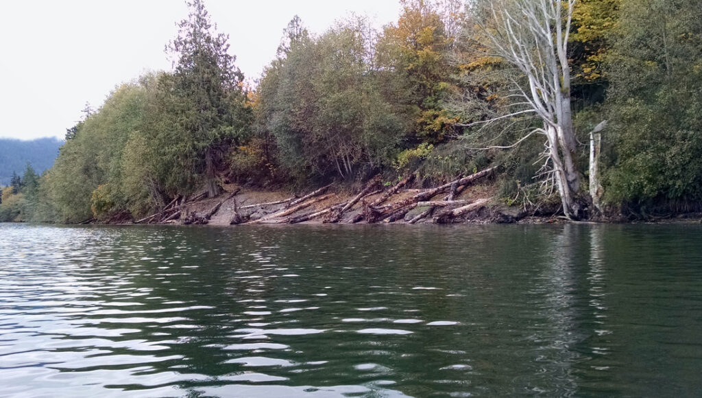
The origins of the Blyn community can be traced back to Benjamin F. Dean relocating his cannery, store and post office from Pitship Point to the south end of Sequim Bay. The community grew and prospered as the logging and agricultural industries fueled the building of homes, stores, a saloon, shingle mill, hotel and a dance hall (originally built to be a chicken coop), all in the early 20th century. Various logging companies were in operation and the log boom was the most prominent features on the shoreline for anyone approaching Blyn from the water. The log boom was in use until 2001. (See Jimmcomelately Creek restoration below.)
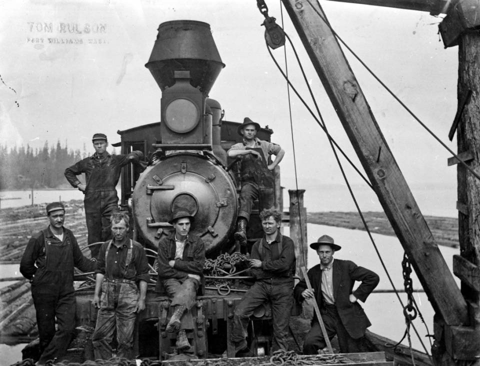
Image courtesy of BERT KELLOGG COLLECTION OF THE NORTH OLYMPIC LIBRARY SYSTEMDate unknown.
JAMESTOWN S’KLALLAM TRIBAL CENTER
The people of the Jamestown S’Klallam Tribe have been have been residents, fisherman, hunters, watermen, stewards, leaders and protectors of Sequim Bay for at least 2000 years. Today, the beautiful buildings that make up the headquarters of the Tribe are located appropriately at the head of the bay where the afternoon summer sun shines brightly and can be seen from anywhere you may paddle on the bay.
Since the signing of the 1855 Point No Point Treaty, few other tribes have been as successful at retaining their autonomy as the Jamestown S’Klallam. This started in 1874 with the formation of the Jamestown community with tribal leader Lord James Balch arranging for the purchase of 210 acres of land just north of Sequim Bay for tribal members to live and continue their traditional ways, thereby avoiding the inadequate living conditions provided at the Skokomish Reservation. The Tribe has continued its entrepreneurial and progressive nature over the past century and in 1981 became Federally recognized as a sovereign nation. At this time they also acquired 2.1 acres of land at the head of the bay for their tribal headquarters and Heron Hall was built 6 years later with more construction to follow. The Tribe also currently owns approximately 100 acres of tidelands at the southern end of the bay.
Known as “The Strong People,” the tribe has historically been recognized for their great fishing, hunting and canoe skills and their lives were sustained by the plentiful wildlife, shellfish and cedar trees that surrounded them at Sequim Bay. Today the Jamestown S’Klallam Tribe are noted for their leadership in resource management in the Dungeness watershed and their business acumen with a number of successful area enterprises including 7 Cedars Casino, The Cedars at Dungeness Golf Course and first rate healthcare provided by the Jamestown Family Health Clinic and Jamestown Family Dental Clinic. For more information and history, please visit their website.
WANT TO READ MORE?
The Jamestown S’Klallam Story: Rebuilding a Northwest Indian Tribe by Joeseph H. Stauss (2002)
Published by the Tribe, this book describes in great detail the daily lives, challenges and successes of the Tribe and its citizens throughout their history.
Available at the Jamestown S’Klallam Tribal Library.
JIMMYCOMELATELY CREEK RESTORATION
Jimmycomelately Creek at the south end of the bay in Blyn is the primary tributary entering the bay. Starting in the late 1880s, Blyn developed into a logging and agricultural area and with this development came many alterations to Jimmycomelately Creek, changing its natural flow and hindering the return of salmon. The creek had been relocated, straightened and wetlands had been dredged and filled to facilitate roads and the log yard that operated there from 1892 until 2001.
Between 2002 and 2005, The Jamestown S’Klallam Tribe along with 27 partner agencies took on the task of restoring the Jimmycomelately Creek ecosystem by realigning the creek channel into its historic channel, restoring the estuary, and constructing a new Highway 101 Bridge. One of many successes of the project can be seen in the return of salmon to the creek. In 1999, a mere seven chum spawners were counted. By 2010, more than 4000 returning salmon were counted!
Click the picture at right to go to the Department of Ecology Coastal Atlas Shoreline Photo site and see how Jimmycomelately Creek and the waterfront was transformed between 1977 and 2016.
“Jimmycomelately Creek” is the official spelling with the United States Board of Geographic Names but you will also see it as “Jimmy Come Lately Creek” (matching the road of the same name) or various hyphenated versions such as “Jimmy-Come-Lately Creek” or “Jimmy Come-Lately Creek.”
In December 2018, the Tribe successfully petitioned to change the name of the adjacent beach to Littleneck Beach, where native littleneck clams have been harvested for centuries. KUOW radio in Seattle produced a wonderful article with fantastic pictures explaining the Tribe’s history with these clams.
You can also read more about the Tribe’s work to restore native Olympia Oysters in their aquaculture operations at the south end of the bay from this article featured in the Seattle Times Sunday Magazine from Sept. 22, 2019.
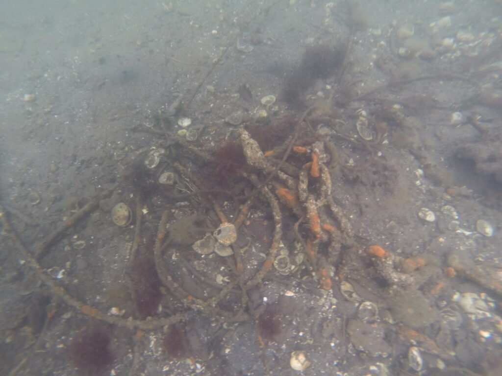
PADDLER’S TIP: The water is very shallow at the south end of the bay so this is a beautiful high tide destination. At lower tides look for remnants of the log boom era just under the water. In the early fall, you’ll see summer chum salmon jumping near the mouth of the creek as they return to spawn.
The Tribe has aquaculture operations in this area so please steer clear of their equipment in the water. Some of it is just below the surface and you won’t see it until you are right on it so if you paddle here be very, very careful.
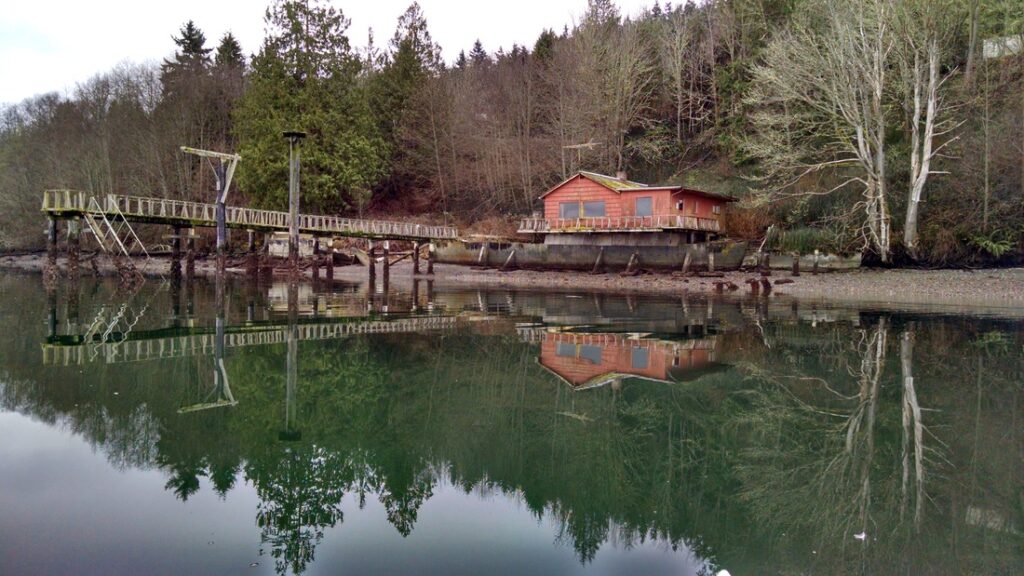
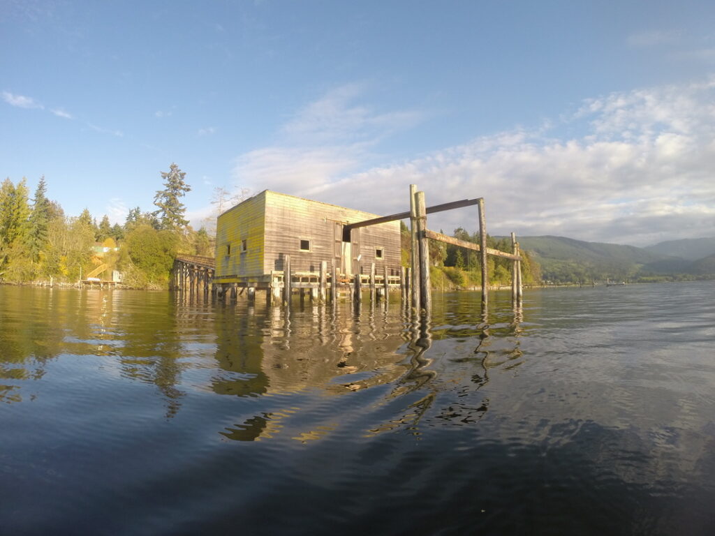
COMMERCIAL SHELLFISH DOCK
If you paddle the southeastern part of the bay you’ll probably spot this large dock building situated out over the water. This dock is owned and was operated by the J & G Gunstone company, a prominent commercial shellfish operation that owned many of the tidelands around the bay. Local aquaculture expert Peter Becker Ph.D., owner of Olympic Aquafarms and former Senior Scientist at Battelle Marine Science Laboratory tells us, “The Gunstone, Johnston and Broder families used the dock to land fish and crab until the 1970’s and a clam processing plant stood on the site with a track up the pier to move hand cars of produce to trucks.” (See our shellfish section below for more info.)
UPDATE: Winter 2018-2019 took its toll on this structure and the Northeast side fell into the bay and the rest of it is now partially collapsed.
THE FOUR POINTS
SCHOOLHOUSE POINT – This point is located just southeast of the State Park. Originally named Sail Point by the Wilkes Expedition, later Skull Point and at one time “Purdy Spit” for landowner Jack Purdy, Schoolhouse Point was one of the locations of the Burrowes School and like the Washington Harbor school, some students arrived by boat. Prior to the school, the point was also said to be a home for Native Americans.
HARDWICK POINT – In the middle of the bay on the east side, Hardwick Point was originally called Takup Point by the Wilkes Expedition and known also as White Point. It was later named Hardwick Point for boat Captain Fred Hardwick who would ferry passengers from Blyn to Port Williams by appointment.
GOOSE POINT – On the east side of the bay, between Hardwick Point and Blyn is Goose Point which was first given the name Spak Point by the Wilkes Expedition.
PITSHIP POINT – see John Wayne Marina above
PADDLER’S TIP: If you visit all four points in one roundtrip you’ll cover about 5 miles.
PORT WILLIAMS
Although it’s located outside the bay it is closely linked to the bay historically and a great spot to from which to launch. The wharf was built in 1890 and later purchased by Hans J. Bugge and served as the primary access to Sequim by Mosquito Fleet steamers. The port included a hotel, restaurant, post office, store and dance hall and many impressive historic photos show boats coming and going from the dock. Today Port Williams is a county park and nothing of the original dock or buildings remains.
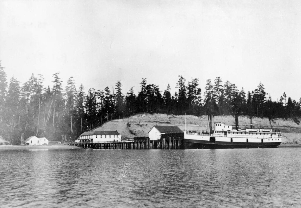
Image courtesy of the Museum and Arts Center in Sequim~Dungeness
The exact date is unknown, but the ship, the Alice Gertrude, was built in 1898 and in 1907 it ran aground in Clallam Bay, never to sail again.
PADDLER’S TIP: If traveling into the bay from Port Williams, pay close attention to the tides beforehand because the current at the entrance to the bay can be quite strong. See “Tides, Currents and Boat Traffic” above.
BEYOND THE BAY
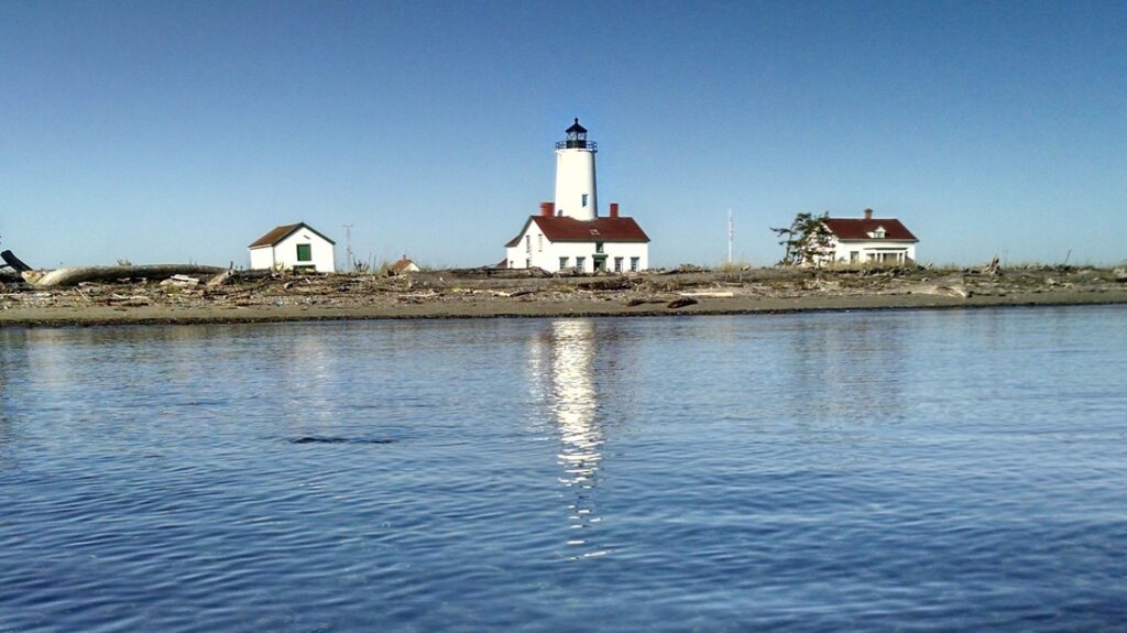
NEW DUNGENESS LIGHTHOUSE – There is so much history, wildlife and scenic beauty here we could easily add another webpage dedicated solely to this first class paddle destination. Launch from Cline Spit or Dungeness Landing (very shallow here, keep an eye on the tides!) Check out their website and remember to call ahead if you want to land at the lighthouse.
PROTECTION ISLAND – Rising from the waters of the Salish Sea, just east of Sequim Bay is Protection Island. You’ll spot the island from the north end of the bay and with Mount Baker as a backdrop, it is the centerpiece of one of the most scenic views on the bay. Protection Island is a National Wildlife Refuge and paddlers and boats are required to stay 200 yards offshore. For more information visit the U.S. Fish and Wildlife website or check out this article on the island’s caretaker from the Sequim Gazette.
WILDLIFE
BIRDS
The entire Sequim area is a birder’s paradise and Sequim Bay is no exception. Clallam County’s bird list is at 370 with 284 spotted in 2014. Some birds are here year round but each changing season brings a new and diverse assortment of waterfowl and shorebirds that make Sequim Bay their seasonal home. American Wigeons, Buffleheads, Glaucous-winged and Olympic Gulls, Dunlins, Western Sandpipers, Black-bellied Plovers, Green-winged Teals, Cormorants and Mallards are some of the most common you’ll see. Before paddling we highly recommend stopping by the Dungeness River Audubon Center in Sequim to get an idea of what birds to look for during your trip out. BirdWeb is another great resource to help identify birds you’ve seen.
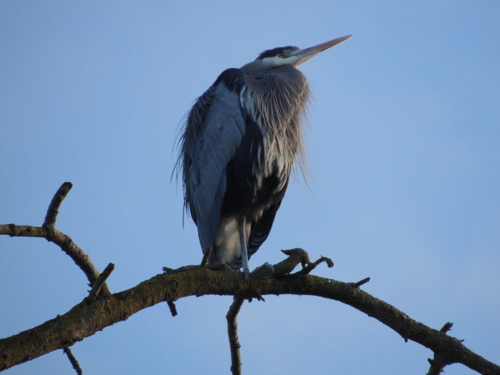
BIRDS YOU MAY SEE ON SEQUIM BAY AND NEARBY SHORELINES (DEPENDING ON SEASON)
Geese and Ducks
Brant, Canada Goose, Trumpeter Swan, Gadwall, Eurasian and American Wigeon, Mallard, Northern Shoveler, Northern Pintail, Green-winged Teal, Greater Scaup, Harlequin Duck, Surf Scoter, White-winged Scoter, Long-tailed Duck, Bufflehead, Common Goldeneye, Barrow’s Goldeneye, Hooded Merganser, Common Merganser, Red-breasted Merganser
Loons
Red-throated Loon, Pacific Loon, Common Loon
Grebes
Pied-billed Grebe, Horned Grebe, Red-necked Grebe, Western Grebe, Eared Grebe
Cormorants
Pelagic Cormorant, Double-crested Cormorant
Herons
Great Blue Heron
Osprey, Eagles, Hawks
Osprey, Bald Eagle, Northern Harrier, Red-tailed Hawk
Rails and Coots
American Coot
Shorebirds
Black-bellied Plover, Semipalmated Plover, Killdeer, Black Oystercatcher, Greater Yellowlegs, Lesser Yellowlegs, Spotted Sandpiper, Whimbrel, Marbled Godwit, Sanderling, Western Sandpiper, Least Sandpiper, Dunlin, Long-billed and Short-billed Dowitcher, Wilson’s Snipe
Gulls, Terns
Heermann’s Gull, Mew Gull, Ring-billed Gull, California Gull, Herring Gull, Thayer’s Gull, Western Gull, Glaucous-winged Gull, Olympic Gull, Caspian Tern, Common Tern
Alcids
Common Murre, Pigeon Guillemot, Marbled Murrelet, Rhinoceros Auklet
Kingfishers
Belted Kingfisher
Falcons
Merlin, Peregrine Falcon
FUN FACT: Did you know there is no such thing as a seagull or a seahawk? This KUOW story explains the misnomer.
MAMMALS
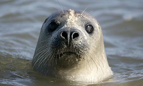
HARBOR SEALS – During most paddle trips you’ll spot at least one harbor seal patrolling the bay and usually quite a few. Often they spot you first and you might be surprised when you turn around and find them following you as you paddle. The newborns start to appear in July and you’ll see them sticking close to their mother’s side.
ORCAS – One historical source mentions that at one time, orcas made a yearly appearance inside the bay during March and April. Currently they can be found traversing the waters of the Strait of Juan de Fuca and Puget Sound and will make a rare visit to the area. Orcas were spotted in the bay on Sept. 3, 2015 and at Port Williams in June of 2011. Unconfirmed report of an orca on Aug. 4th, 2019 to a Sequim photography Facebook group. Orcas made another appearance on Sept. 18, 2023 and again August 2024. Needless to say, they make regular visits.
GRAY WHALE – I haven’t run across any historical mentions of gray whales in Sequim Bay but I saw one on April 17th, 2018. Here’s the story: While I was on the water just south of John Wayne Marina, I saw a spray of water, like a whale spouting, about 50 yards away but I wasn’t sure because it was so windy and the water was choppy and I only caught a quick glimpse of it. After sitting on my board for 10 minutes or so, scanning the water and not seeing it again, I paddled back to shore thinking it must have been a bird or seal or I just imagined it. As I walked back to my car with my board, a guy named Don walked up and said, “Did you know a whale was following you out there? It surfaced twice right behind you.” Umm…No I didn’t know that (so no picture). Later as I was packing up I saw it surface and sure enough, a gray whale, right at my launch spot on Sequim Bay. Whales in the bay are extremely rare so this was kind of extraordinary.
RIVER OTTERS – There is family of river otters I’ve spotted a few times now on the south and southwest side of the marina. You’ll see them playing in the water or perhaps poking their heads out from the rocks that surround the marina. New babies seem to arrive in June.
HARBOR PORPOISES – On May 8th, 2020, I spotted two harbor porpoises in Sequim Bay for the first time. Their numbers have been increasing significantly in the Salish Sea for the past two decades following a steep decline.
ELEPHANT SEAL – On July 28th and 29th, 2019 I had the pleasure of seeing my first elephant seal in Sequim Bay. It was a female and I wasn’t the only one who saw her because she was feeding outside the south end of the marina and clearly visible from the park. I was able to capture video and pictures of her eating a Pacific spiny dogfish (a type of shark). I saw her eat two. Amazing experience!
FISH, SHELLFISH AND CRAB
Fish, shellfish and crab have sustained the S’Klallam people for thousands of years at Sequim Bay and continued for many years to provide commercial and sport fisherman with an abundant bounty. At one time, herring were so plentiful that Tribal fisherman would use a rake like tool to simply pull them into the canoe.
The signs of shellfish life are unmistakable with empty and broken shells scattered at nearly every shoreline. The J & G Gunstone company were the most notable commercial clam harvesters at Sequim Bay. According to local aquaculture expert Peter Becker Ph.D., owner of Olympic Aquafarms and former Senior Scientist at Battelle Marine Science Laboratory, “Gunstone and Johnson started farming native littleneck clams (Prothaca staminea), called the Washington Clam, in 1923 and own some 20,000 feet of shoreline in Sequim and Discovery Bays, as well as the adjacent tidelands. They have shipped their quality shellfish to Oregon, California, Nevada, Utah and other states ever since.” In recent decades, shellfishing harvests have become unreliable due to water quality issues with seasonal closures due to red tide blooms. Some of the beaches are often closed to shellfishing these days due to biotoxins in certain species and you will see warning posted at access points to the beaches. Please see the Washington Department of Fish and Wildlife website for closures, seasons, and identification help.
FISH – Pacific spiny dogfish (a type of shark), Summer chum (Dog) Salmon, Steelhead (sea-run rainbow trout), Coho (Silver) Salmon, Sea-run cutthroat trout, Chinook (Blackmouth) salmon, Pacific staghorn sculpin, Shiner perch, Surf smelt, Starry flounder, Snake prickleback, Saddleback gunnel, Three-spine stickleback, Pile perch, Herring, Bay pipefish, Sand lance, Arrow goby, Crescent gunnel, English sole, Prickly sculpin, Whitebait smelt, Capelin, Bocaccio, Rock greenling, Rosylip sculpin, Roughback sculpin, Mosshead sculpin, Fluffy sculpin, Spiny sculpins, Silverspotted sculpin, Spinyhead sculpin, Northern spearnose poacher, Tubenose poacher, Sturgeon poacher, Pacific spiny lumpsucker, Black prickleback, Northern clingfish, C-O sole
* Many fish on this list come from a 2015 NOAA Professional Paper, “Fishes of the Salish Sea: A Compilation and Distributional Analysis” by Theodore W. Pietsch and James W. Orr.
SHELLFISH – Littleneck Clams, Manila Clams, Butter Clams, Geoduck Clams (pronounced gooeyduck), Horse Clams, Pacific Oysters, Cockles, Mussels
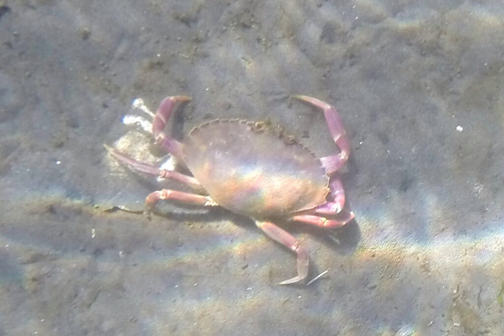
CRAB – Dungeness crab, Red rock crab, Graceful crab (Slender Crab), Hermit crabs, Purple shore crabs, Hairy shore crabs, Decorator crab, Northern kelp crab
OTHER SEA LIFE
Jellyfish (mostly moon jellies), Ctenophores (comb jellies), Crangon shrimp, Pandalid shrimp, Mysids (opossum shrimps), Spot prawns, Sea stars, Sand dollars, and Anemones, Sea lemon (nudibranch), Hooded (or Lion’s mane) nudibranch
EELGRASS – Paddlers on Sequim Bay will see eelgrass under their boat at almost every shoreline. It plays an important role in the nearshore ecosystem by providing feeding grounds, hiding spots and spawning grounds for fish. Eelgrass beds are essential to the sustainability of the food chain as larger fish and birds feed on the small fish and other invertebrates hiding in the eelgrass.
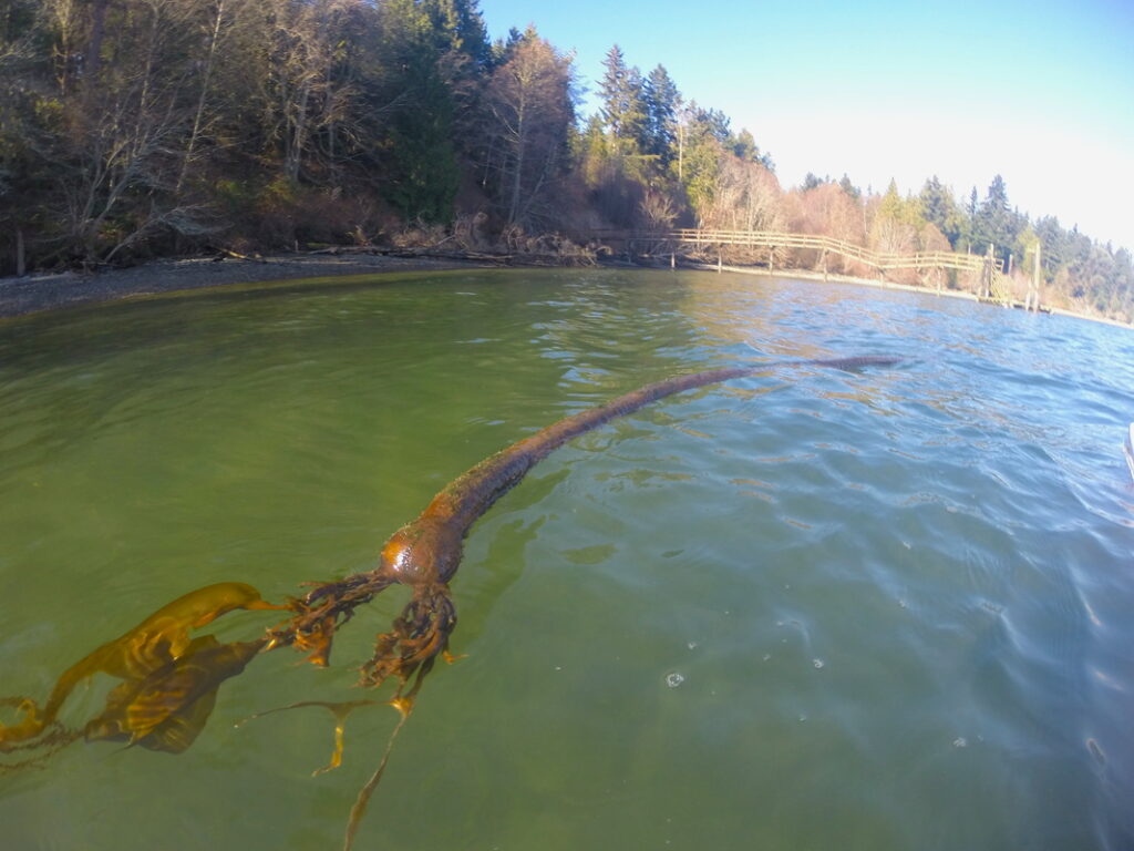
BULL KELP – The most dominant kelp in Washington, bull kelp’s name is derived from its resemblance to a bull whip. It’s the fastest growing seaweed in the world, growing as much as two feet in one day and can become 120 ft. long or more. Like eelgrass, kelp forests provide essential habitat for many sea creatures above and below the water.
Resources
PLACES
Jamestown S’Klallam Tribal Library
North Olympic Library System
Sequim Museum and Arts Center
Jefferson County Historical Society
BOOKS
Lucus, Patricia L. Sequim Bay Point. 1993.
Fish, Harriet. Fish Tales of Sequim Bay. 1985.
Keeting, Virginia (ed.), Sequim Bicentennial History Book Committee. Dungeness: The Lure of a River. Port Angeles, Washington, 1976
Stauss, Joeseph. The Jamestown S’Klallam Story: Rebuilding a Northwest Coast Indian Tribe. Jamestown S’Klallam, Sequim, Washington, 2002.
Grender, Pamala Kay. Faded Treasures, Vibrant Lives. Little Creek Press, 2011.
Russell, Jervis (ed.) Jimmy Come Lately (History of Clallam County: A Symposium). Clallam County Historical Society, Port Angeles, Washington, 1971.
Gunther, Erna, Klallam Folks Tales and Klallam Ethnography. Seattle: University of Washington Press, 1927
REPORTS
Onat, Astrida R Blukis and Larson, Lynn L. 1984. Report of Testing of 45CA227, Washington Harbor and Cultural Resources Overview at the Battelle Marine Research Laboratories, Sequim, Washington.
Port of Port Angeles. 1977. Final Environmental Impact Statement: Sequim Bay Small Boat Haven.
Nelson-Gross, Kristina. 2012. City of Sequim Inventory and Characterization Report.
Prepared for the City of Sequim, WA
Shreffler, D. (ed.). 2012. Jimmycomelately Ecosystem Restoration: Monitoring Report 2004 – 2011
Prepared by Shreffler Environmental for Jamestown S’Klallam Tribe, Sequim, Washington.
Norris, James G., Ian E. Fraser and Hannah Julich. 2012. Underwater Videographic Survey of Submerged Aquatic Vegetation in Sequim Bay, WA
August 2011.
Prepared by Marine Resources Consultants for Jamestown S’Klallam Tribe, Sequim, Washington, March 31, 2012. <http://www.researchgate.net/publication/232058519_Underwater_Videographic_Survey_of_Submerged_Aquatic_Vegetation_in_Sequim_Bay_WA>
Parametrix. 2009. S 101, East Sequim Bay Road Access Point Interchange Justification Report.
Prepared by Parametrix for Jamestown S’Klallam Tribe, Sequim, Washington.
Penttila, D. 2007. Marine Forage Fishes in Puget Sound, Puget Sound Nearshore Partnership Report No. 2007-03. Published by Seattle District, U.S. Army Corps of Engineers, Seattle, Washington. <http://www.pugetsoundnearshore.org/technical_papers/marine_fish.pdf>
Pietsch, Theodore W., and James W. Orr. 2015. Fishes of the Salish Sea: a compilation and distributional analysis. NOAA Professional Paper NMFS 18, 106 p. doi:10.7755/PP.18 <https://www.researchgate.net/publication/282575569_Fishes_of_the_Salish_Sea_a_compilation_and_distributional_analysis>
JAMESTOWN S’KLALLAM TRIBE HANDOUTS
Jimmycomelately Creek and Estuary Restoration. Jamestown S’Klallam Tribe, Sequim, Washington. Pamphlet.
Jimmycomelately Ecosystem Restoration Project. Jamestown S’Klallam Tribe, Sequim, Washington. Pamphlet.
Self Guided Tour and Map of the Jamestown S’Klallam Tribal Campus. Jamestown S’Klallam Tribe, Sequim, Washington. Pamphlet.
Jamestown S’Klallam Tribe, The Strong People. Jamestown S’Klallam Tribe, Sequim, Washington. Pamphlet.
ARTICLES AND LINKS
Mizar, Renee. “Unearthing Tribal History at MAC.” Sequim Gazette, Sequim, Washington. March 2014.<http://www.sequimgazette.com/community/252517031.html>
Van Horn, Denny AFMJ. “Our Birds: 2014, ‘Twas the year that was…” Sequim Gazette, Sequim, Washington. January 28, 2015. <http://www.sequimgazette.com/community/289961071.html>
Smillie, Joe. “Work at Sequim’s Battelle lab ‘critical,’ director tells chamber of commerce.” Peninsula Daily News, Port Angeles, Washington. July 24, 2014. <http://www.peninsuladailynews.com/article/20140726/news/307269955/work-at-sequims-battelle-lab-critical-director-tells-chamber-of>
McDonald, Lucile. “Sequim Today: A Growing Community.” Seattle Times Magazine, Seattle, Washington. January 22, 1961.
Moody, Dick. “Bugge Will Clam While Battelle Builds.” Seattle Times, Seattle, Washington. Sept. 11, 1966.
“Raymond Hague dies; retired executive.” Seattle Times, Seattle Washington. July 9, 1976
Hansen, Ariel. Dawley Land Donated to State for Wildlife Refuge. Sequim Gazette July 19, 2006 <http://www.citizenreviewonline.org/July_2006/20/dawley.html>
http://en.wikipedia.org/wiki/Francisco_de_Eliza
http://en.wikipedia.org/wiki/Manuel_Quimper
Washington Department of Ecology Coastal Atlas, Shoreline Photos
North Olympic Heritage photos
North Olympic Library System
http://www.clallam.net/maps/
http://www.visitsunnysequim.com/
http://www.sequimgazette.com
SPECIAL THANKS
Judy at the Sequim Museum and Arts Center
The librarians at the Jamestown S’Klallam Library
The librarians at the Port Angeles Library
S’Klallam Tribal Elder Marlin Holden
Peter Becker Ph.D., owner of Olympic Aquafarms and former Senior Scientist at Battelle Marine Science Laboratory
Bob Boekelheide and the Dungeness River Audubon Center
David Brownell, former Tribal Historic Preservation Officer, Jamestown S’Klallam Tribe
All research and writing for this page was compiled by Shanon Dell. Most of that was done in 2014-2015 with a few updates after.
Copyright – Given to Glide Paddle Sports – 2025
No posts were found.
